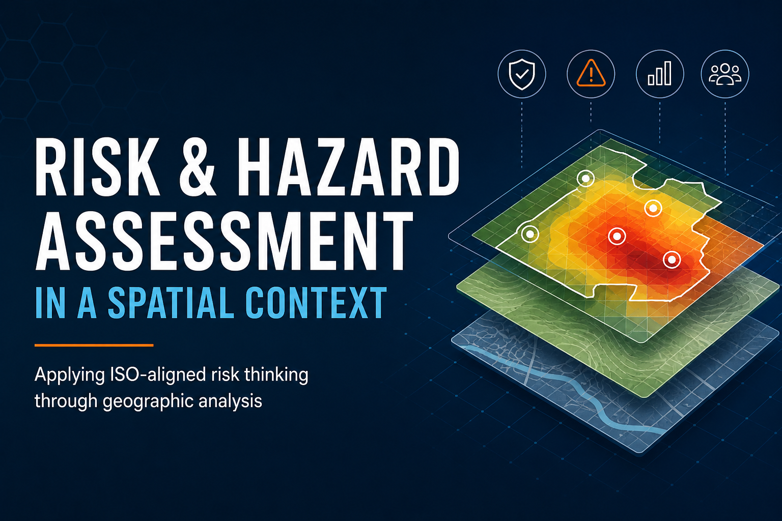
Applying ISO-aligned risk thinking through geographic analysis
Risk occurs somewhere.
Whether organisations are managing public safety, infrastructure, environmental exposure, emergency management, recreation, or operational performance, many risk questions are inherently geographic:
- Where are incidents occurring?
- Which locations experience higher exposure?
- Are there identifiable hotspots or clusters?
- Which assets or communities may be most vulnerable?
- Where should resources or treatments be prioritised?
Traditional risk registers and qualitative assessments remain important, but spatial analysis can provide an additional layer of insight that strengthens evidence-based decision making.
Frameworks such as ISO 31000 and ISO/IEC 31010 provide strong foundations for structured risk management. While these standards are not specifically spatial standards, many of their principles and assessment approaches align naturally with geographic analysis.
ISO 31000 and Spatial Context
A central principle within ISO 31000 is that risk should be understood within organisational and external context.
Spatial analysis helps organisations better understand that context by identifying how geography, environment, infrastructure, access, population, and operational conditions may influence risk exposure and outcomes.
This can support organisations to:
- visualise risk geographically
- identify concentrations and trends
- improve situational awareness
- prioritise treatment activities
- communicate risk more effectively
- support monitoring and review processes
Importantly, spatial analysis should support — not replace — governance, operational knowledge, and professional judgement.
Moving Beyond “Pins on a Map”
Many organisations already use maps operationally, but modern spatial risk assessment extends far beyond simple visualisation.
Spatial workflows can incorporate:
- hotspot and density analysis
- proximity and accessibility assessment
- spatial clustering
- exposure modelling
- environmental overlays
- temporal trend analysis
- standardised incidence or rate calculations
- vulnerability mapping
- predictive or scenario-based modelling
The objective is not simply to display data geographically, but to better understand how location and environment influence risk.
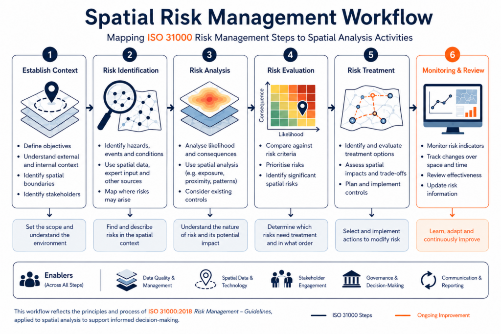
Applying ISO/IEC 31010 Approaches Spatially
ISO/IEC 31010 outlines a range of recognised risk assessment techniques. Many of these can be adapted into spatial analysis frameworks depending on organisational objectives, available data, and operational maturity.
1. Risk Identification
Spatial analysis can assist with identifying where hazards, incidents, or vulnerabilities may exist.
This may include:
- incident mapping
- environmental overlays
- infrastructure interaction analysis
- activity exposure mapping
- trend visualisation
These approaches can help organisations move from assumptions toward measurable geographic patterns.
2. Consequence and Likelihood Analysis
Spatial frameworks can strengthen likelihood and consequence discussions by incorporating geographic exposure indicators such as:
- population or visitation density
- traffic flows
- remoteness
- environmental conditions
- historical incident frequency
- accessibility constraints
In some cases, organisations may also develop geographically weighted risk surfaces or multi-criteria spatial models to compare relative risk across operational areas.
3. Spatial Patterns and Environmental Relationships
Spatial analysis can help organisations move beyond simple incident counts toward understanding how environmental and operational factors may influence risk.
This may include examining relationships between incidents and factors such as:
- infrastructure proximity
- environmental conditions
- accessibility
- land use
- visitation patterns
- remoteness
- terrain
- weather exposure
- activity intensity
Methods drawn from spatial statistics and spatial epidemiology can assist in identifying clustering, concentrations, emerging hotspots, or unusual geographic patterns.
These approaches can help organisations better understand where risk may be elevated, where additional controls or investigation may be required, and how operational resources may be prioritised geographically.
4. Scenario and Exposure Modelling
Scenario-based approaches can also benefit from spatial analysis.
Examples may include:
- flood or coastal inundation modelling
- wildfire spread scenarios
- evacuation analysis
- infrastructure failure impacts
- climate exposure assessment
- visitor movement or surge modelling
Spatial modelling allows organisations to assess how consequences may vary geographically under different operational or environmental conditions.
5. Monitoring and Review
One of the strongest applications of spatial analysis is ongoing monitoring.
Spatial reporting frameworks can help organisations track:
- emerging hotspots
- changing exposure patterns
- treatment effectiveness
- regional variation
- operational drift over time
This aligns strongly with the continual improvement principles embedded within ISO 31000.
The Importance of Context
Spatial outputs should always be interpreted carefully within organisational context.
A concentration of incidents in one area does not automatically indicate elevated risk. Patterns may instead reflect:
- higher activity levels
- improved reporting
- population distribution
- seasonal variation
- environmental conditions
- operational changes
This is why governance, contextual understanding, and professional judgement remain critical components of effective risk management.
Final Thoughts
ISO 31000 and ISO/IEC 31010 provide valuable foundations for structured risk thinking. Spatial analysis extends these concepts into the geographic domain by helping organisations better understand where risk occurs, how exposure varies, and where interventions may be most effective.
As spatial technologies and analytical workflows continue to evolve, geographically informed risk assessment is becoming increasingly valuable across many industries.
Future articles will explore practical spatial workflows, hazard modelling techniques, exposure analysis, and modern GIS-based approaches for risk and hazard assessment.